and the secrets of the satellites
Inspired in part by Indiana Jones, space archaeologist Sarah Parcak uses futuristic airborne technology to unearth the treasures of the past
Sarah Parcak approaches the towering 40-foot-long creature. Its flashing rows of serrated teeth are built to grab flesh and crush bones. If it could sense we’re near, it would be upon us in seconds.
“There she is,” whispers Parcak. “Thank you for indulging me.”
Parcak inches forward. Wearing a brown leather jacket and a cream-colored scarf printed with Egyptian hieroglyphs, she widens her eyes and opens her mouth into a silent scream.
Click! Parcak snaps a selfie. In the resulting image, she appears to be fleeing in horror from Sue the T. rex, the 67 million-year-old dinosaur skeleton that’s one of the crown jewels of Chicago’s Field Museum. When Parcak and I met earlier this August morning, her first request was to see this famous fossil, the most complete Tyrannosaurus rex ever found.
Parcak tweets the selfie to Sue, who, she explains, has her own “sassy, sassy” Twitter account. “I forgot the ham so @SUEtheTrex roared,” tweets Parcak. “I’m so sorry Sue I’ll do better.”
Sue, she explains, likes ham.
Leaving Sue behind, we pass another prehistoric creature, a triceratops, Sarah Parcak’s favorite dinosaur. Say its name aloud and you’ll realize why.
“You get to the world of the living by digging in the world of the dead.”
Parcak’s Twitter handle is @indyfromspace. That’s “Indy” for Indiana Jones, the fictional archaeology professor, and “space” because Parcak, a National Geographic Explorer, TED Prize winner, and member of the Rotary Club of Birmingham, Alabama, isn’t just any kind of archaeologist. She’s a space archaeologist whose work begins in the heavens to help her discover what’s hidden beneath the earth’s surface. Using satellite photos, Parcak has identified thousands of previously unknown sites: 1,000 potential tombs, 17 potential pyramids, and 3,100 potential settlements in Egypt alone, including Tanis, the “lost city” made famous in Raiders of the Lost Ark, the first film of the Indiana Jones franchise. (See “A Lost City and a Childhood Dream,” below.)
Before the Space Age, archaeologists often had few hints about where to start digging. In an ocean of sand, they looked for clues such as stone fragments that were once walls or dense concentrations of slag that may indicate a site where metal was produced. But sometimes there are no obvious signs of a vanished city or civilization. The field of space archaeology helps point the way.
Space archaeologists such as Parcak look at satellite pictures and other remote images for the outlines of structures long buried underground. For example, plants growing over a stone structure will not be as healthy as those growing over other ground; space archaeologists can see these subtle differences in their chlorophyll levels by manipulating the light spectrum using the archaeologist version of Photoshop. Or they look at three-dimensional images created by pulsing lasers mounted on airplanes or helicopters, which reveal ancient sites obscured in dense jungle. Drones may soon advance the field even further.
These whiz-bang techniques might help researchers better decide where to dig, but they still have to excavate the old-fashioned way to see if they’re right, a process known as “ground truthing.” Parcak went on her first dig in 1999, in the Nile Delta after her second year of college, but these days, she’s the excavation director in charge of a team of up to 100 people. “If I do my job right, it means everyone else does their job without being bothered,” she says.
Digging happens for only a couple of months a year, so Parcak spends the vast majority of her time teaching as a professor at the University of Alabama at Birmingham, applying for permits and funding, and attending meetings. “I don’t want to sound like I take it for granted, but I think a lot of the process of science never gets talked about in the press,” she says. “It’s nice, but it’s science and it takes time. I don’t find something every five minutes. And like everyone else I know who does this work, we do our science at 10 o’clock at night after the kids are in bed.”
-

Sarah Parcak wrote her book Archaeology from Space to inspire kids: “I don’t care if they’re archaeologists. I want them to be whatever they desire. I hope it inspires them to think that they can do what they want.”
-

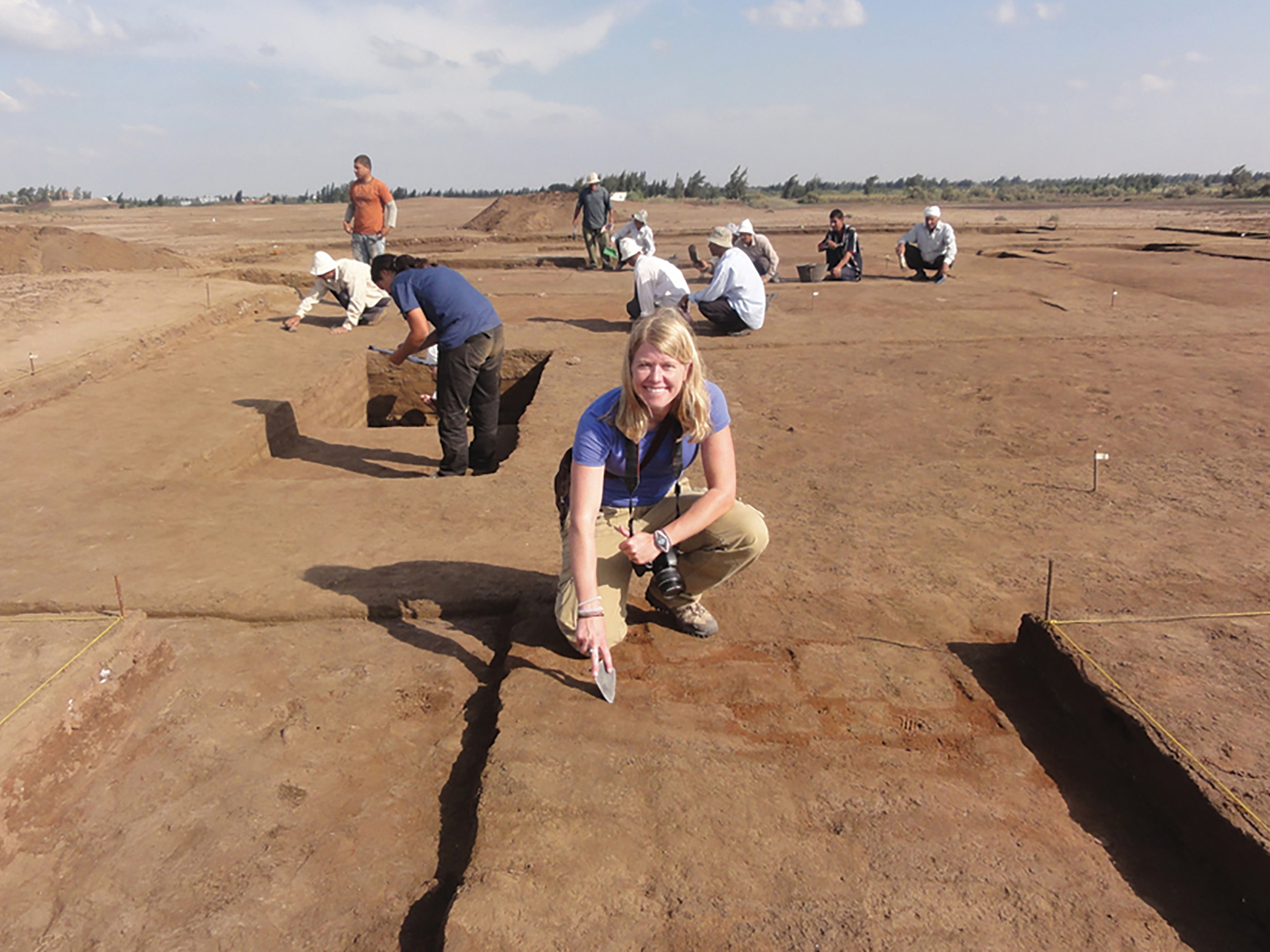
Digging at Lisht, Egypt, where an expedition co-led by Parcak discovered more than 800 tombs in a single field season.
-

The completed excavation.
-

Parcak and her team used satellite images to identify looting at Saqqara, an ancient Egyptian burial ground.
Image courtesy of DigitalGlobe


Parcak’s fascination with Sue the T. rex makes sense when you consider that Parcak has her own sassy Twitter presence. She’s one of a media-savvy cohort of young archaeologists who use social media to live-tweet digs, poke at pseudoscience, and share science jokes. But dinosaurs aren’t her specialty. She’s an Egyptologist, after all. So we head to the Field Museum’s “Inside Ancient Egypt” exhibit, where we walk into a three-story replica of a mastaba, a type of ancient Egyptian tomb.
Parcak is hyped up on caffeine and talking a little fast, and it’s all I can do to keep up. She took the last flight into Chicago the night before so she could maximize time with her family, which includes husband Greg Mumford, a fellow archaeologist whom she proposed to at the Egyptian Museum in Cairo, and their son, Gabriel, whose birthday happens to be tomorrow. “I had four cups of coffee before this,” she says, “because … travel.”
I can practically see the hashtag in my head.
It’s a busy day at the museum, and our visit is punctuated with the sounds of children shouting as they run around among the mummies, jewelry, and ceramics. We reach two original chambers from the Old Kingdom burial site, made of limestone blocks carved 5,000 years ago. Hieroglyphs on the walls show servants trussing geese and bringing offerings. Parcak explains to me how the seemingly two-dimensional art is three-dimensional after all — that is, once you learn to look at it through the eyes of an Egyptian from 2400 B.C. My mind is blown.
A tour group that has been trailing us catches up. Their guide, not realizing who Parcak is, invites us to join them. We climb to the roof of the mastaba instead.
Parcak credits two major influences on her path to becoming a space archaeologist: Indiana Jones (do you sense a theme?) and her grandfather.
As a child of the 1980s, she would spend Friday nights watching movies on VHS with her family in their home in Bangor, Maine, and Raiders of the Lost Ark was in heavy rotation. The adventure in the movie called out to her. (After giving a TED Talk in 2016, she got to meet Harrison Ford, who plays Indiana Jones; she had brought a brown fedora, Indy’s signature chapeau, and there’s a photo of them fighting over the hat.) Parcak became so obsessed with Egypt that she dressed as a mummy for a school project in seventh grade, wrapping herself in toilet paper and rising out of a refrigerator box accurately decorated as a sarcophagus.
Later, when it came time to study archaeology in college, it was her grandfather Harold Young who influenced her trajectory. Young had been a paratrooper in World War II and would plot his landing positions using aerial photographs. After the war, he became a professor of forestry at the University of Maine, where he developed new techniques to map tree heights. As a child, Parcak would look through his stereoscope, a device like the old View-Master toy that created three-dimensional images by looking at two copies of a photo from slightly different perspectives. She learned more about his research after he died, and she was intrigued enough that during her senior year at Yale she took an intro class on remote sensing. That class led to a master’s and a PhD at Cambridge, and to her career today.
Parcak found a new focus after rumors surfaced of large-scale looting of famous Egyptian burial sites in the wake of the Arab Spring. Responding to an email discussion group of archaeologists, she wrote that the only way to know if looting had happened would be to compare before and after satellite images. The editor-in-chief of National Geographic took interest, and the National Geographic Society began collaborating with her to map the plundering. Soon, she and colleagues had identified 200,000 looting pits at 279 archaeological sites across Egypt. The signs were often clear: bulldozer tracks or dark squares surrounded by a doughnut of earth. On the images, they look like pimples dotting the terrain.
Parcak had an ambitious idea: to build an online platform to crowdsource the job of finding and protecting the world’s heritage. That idea won her the $1 million TED Prize for 2016 — the same year she spoke at the Rotary International Convention in Seoul, Korea — and she used the money to build GlobalXplorer.org, where citizen-scientists receive a short tutorial and then look at satellite images for telltale signs of looting and ancient structures.
The project started by looking at images from Peru because of that country’s existing innovative work in archaeology. In a little over a year after the platform’s launch, more than 80,000 people from over 100 countries signed up. An assessment found that these untrained members of the public, who ranged in age from young children to the elderly, have a 90 percent accuracy rate. What they find will help ensure the protection of these sites in the future.
Archaeology can be a path to peace, as well as to the past.
We head downstairs to the lower level of the Field Museum and take a look at Middle Kingdom coffins and soul houses, which are like the dollhouses of the great beyond — small clay replicas that often contain sculpted foods to feed the dead in the afterlife. Researchers love them because they show what the buildings of antiquity looked like. As we’re talking about why archaeologists are so interested in tombs — “The irony is you get to the world of the living by digging in the world of the dead,” Parcak explains — I notice a woman listening in. Eventually, she interrupts us. “Sarah?” she asks.
It ends up being another world-renowned Egyptologist, Emily Teeter. The two exchange the usual pleasantries: How’s the family, what are you doing here, what’s next for you. “Small world,” Parcak says as we part ways. “It’s such a small community of Egyptologists.” And here they are in Chicago’s version of Egypt.
We meander through a marketplace scene, checking out 5,000-year-old burnished pottery. “This tends to be most of what we find on excavations: tens of thousands of pieces of pottery,” Parcak says. “There are people who are going to be born in hundreds of years, and they’re going to be specialists in Tupperware.” We see mummified falcons and a pair of woven reed shoes; their backs curve up, making the footwear look like giant commas. “The Louboutins of antiquity,” Parcak says. “Those are fancy. Someone’s wearing shoes like that, you know they’re rich.”
In the middle of the marketplace, Parcak pulls out her phone and checks Twitter.
Sue has retweeted her.
-

Parcak’s field is changing rapidly as computers grow more powerful: “The computers are so good now that I can go to a coffee shop and process satellite imagery.”
-

Skagafjörður in northern Iceland, where Parcak used satellite imagery to identify evidence of Viking settlements.
-

Parcak used image processing techniques to reveal the ancient settlement of Tanis.
-

Parcak digging at Tanis.


“Think of life as a pendulum, not a balance. That will really shift your mindset.”
We stop at a display cabinet filled with bronze statues of the Egyptian god Osiris and chat about why we should bother studying archaeology at all. This is something that Parcak has a lot to say about.
“When you stand in front of the pyramids, or watch the kids walking around here today with big eyes, it’s because they are in awe,” she says. “When you have awe, it means you are thinking of yourself in relationship to whatever you’re seeing. You see yourself as small in the arc of time. You open yourself up to the accomplishments of other groups of people. It means perhaps you’re open to the idea that people today from other places have value too.”
Archaeology, in other words, can be a path to peace, as well as to the past.
One of the reasons Parcak wrote her recent book, Archaeology from Space: How the Future Shapes Our Past, was to underscore that point and to counter some of the pseudoscience out there. A television show called Ancient Aliens, which hypothesizes that aliens had a role in building the pyramids, is a frequent target for her ire. “People don’t think it’s racist, but it is,” she says. “Saying that people with darker skin didn’t have the intelligence to do something is the literal definition of racism.”
Helping people understand how ideas have morphed and been reshaped over time, through the work of not just Greek and Roman scholars, but also ancient Egyptians and Islamic scientists and scholars, can help create more tolerance and international understanding today, Parcak says. “The reality is that the whole concept of Western civilization is a lie,” she says. “There is no Western civilization: There is a long arc of time. It’s a big amalgamation of ideas, and we forget that today.”
Archaeology also teaches lessons about what happens to societies in times of great upheaval and climate change, who makes it through, and why. “I wrote my book for kids, for teens, for young students,” she says. “When people read it, they feel a little more hopeful. I don’t want them to feel like everything is going to be OK, because it’s not, but this tempered perspective is what we need more of.”
We look for a birthday gift for her son at the Field Museum’s store and then hop in a taxi to grab lunch. Over bowls of coconut curry, we chat about, in no particular order: our kids (mine is the same age as hers); our husbands; traveling for work with kids; feeding our kids; bedtime routines; anti-princess books; school gardens; tomato seeds; family-friendly workplaces; the morning’s news; the state of journalism; and the problem with the whole concept of work-life balance. “Think of life as a pendulum, not a balance,” she advises. “That will really shift your mindset.” #workingmoms
As we finish up, Parcak folds her napkin, sets it on the table, and looks at me. “Is there a place we can grab coffee around here?” she asks. Then, conspiratorially, she adds: “Or ... I’m not putting any pressure on you, but I’m just saying, Shake Shack is next door. You could get a milkshake.”
I laugh in agreement, and we head over. It turns out that in addition to being an expert on ancient Egypt, Parcak is a connoisseur of frozen custard. She schools me on the flavors: “Black sesame seed if you want to go a little exotic,” she coaches. “I would say with your first one, go with something more standard. No pressure though. You do you.” I opt for salted caramel. Parcak takes my advice and gets a flavor offered only in Chicago called “Penthouse Sweet.”
As we wait for our desserts, Parcak checks her phone and smiles. She shows me her Twitter feed. A friend has posted a gif of Patrick Stewart’s head rolling toward Indiana Jones, a parody of the famous boulder scene in Raiders. And then she has to dash off for an interview at a local radio station. We step out onto busy Michigan Avenue, and Parcak’s cab arrives. “Call me if you’ve any questions,” she says as she tightens her hieroglyph scarf and climbs inside. With a wave of her hand she’s gone, an intrepid explorer of the past racing off to define her future.
• This story originally appeared in the April 2020 issue of The Rotarian magazine.


A lost city and a childhood dream
As a child, Sarah Parcak was captivated by the movie Raiders of the Lost Ark, and her favorite part was the Tanis scene. Tanis was Egypt’s capital for about 350 years, and in the movie, it was buried by a sandstorm and rediscovered by Nazis searching for the Ark of the Covenant, the Old Testament chest that contained the Ten Commandments. Indiana Jones eventually enters an underground room with a 3D map of the city and discovers the biblical relic.
In reality, Tanis is partially buried under the modern city of Sân el-Hagar, about 100 miles northeast of Cairo. The site has been explored since Napoleon’s time, and French archaeologist Pierre Montet discovered the largely undisturbed tomb of Psusennes I, a find that many Egyptologists consider among the greatest of all time. But Montet made his find in 1939, and World War II rendered it a distant memory.
In her book Archaeology from Space: How the Future Shapes Our Past, Parcak details how she stumbled upon the city of her childhood dreams. In 2010, satellite imagery was still expensive and companies didn’t have as many satellites in orbit as they do today, so Parcak had two images of Tanis to work with: a high-resolution image in black and white, and a low-resolution color image.
Playing around with the color image first, she used different parts of the light spectrum to reveal some fuzzy lines that could be buried architecture. Then she took the black-and-white image and used a technique called “pan-sharpening,” in which she merged the two images. The low-resolution image automatically sharpened to the resolution of the high-resolution image. “I almost fell off my seat,” she writes. “I thought I was hallucinating: an entire ancient city leapt off the screen.”
She then tried other processing techniques, which, she explains, were “like tweaking the radio to get the best possible signal.” Ultimately she had a crisp image, “almost like the map room in the Raiders of the Lost Ark scene, with only a little more imagination needed.”
When she got home, Parcak showed her husband, fellow Egyptologist Greg Mumford. She tried to draw a map of the city using her computer. “Greg had the brilliantly simple idea of drawing the town plan by hand, the old-fashioned way,” she writes. “We would print out a massive poster of the satellite imagery for the entire central city, and then cover it with transparent plastic sheeting, to draw in every detail in pen.”
It took two months to draw it bit by bit on the map, which covered their dining room table. Parcak estimates that a traditional ground survey would have cost $200,000 and taken 103 days to do what took them $2,000 in images and 60 hours. A French team later confirmed through an on-site dig one of the houses she had seen in the images.
“We archaeologists have made so many assumptions about major sites around the world,” Parcak writes. “The more satellite technology advances, the more we find out how little we know.”